This article is part of our Cocktail Chatter series, where we dive into the wild, weird, and wondrous corners of history to share over a cocktail and impress your friends.
In a time where just about any data point or piece of history is available at our fingertips, we’re used to taking information at face value. We’re all pretty dependent on the map applications on our phones and in our cars, and it’s not often that we call the directions provided into question. (Michael Scott drove straight into that lake, after all.) Though we tend to assume maps are universally truthful, there was once real incentive for cartographers to be misleading with their craft.
The study and art of cartography goes back tens of thousands of years, with the earliest known maps including a sketching of a Czech Republic town carved into a mammoth tusk that was dated back to 25,000 B.C. Of course, mapmaking evolved over time thanks to several technological leaps including the invention of the compass, printing press, telescope, and sextant. With these tools, people began developing a specialized skill for mapmaking, transforming the practice from a means of survival to a business model.
Once cartography became a profession, the competition was on. Many lived in fear that others would poach their meticulously gathered data. So in order to protect their proprietary maps, cartographers would occasionally plant a fake town or feature to catch competitors in the act. Typically, mapmakers would only include subtle, hidden traps like a slightly-off riverbend or a fictitious dead end. If a cartographer found that other makers’ maps of the area featured these falsifications, that would confirm they were stealing their information.
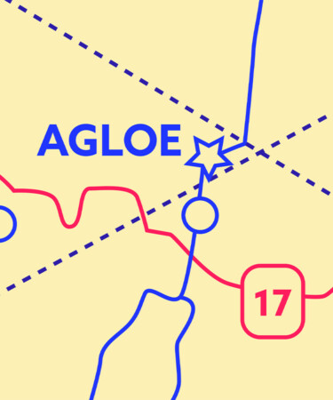
While fabricating entire fake towns was generally considered to be too obvious, there are a few known examples of that strategy. One of the more compelling instances is from the 1930s in upstate New York, where Otto G. Lindberg of General Drafting Co. and his assistant Ernest Alpers created the town of Agloe — a mix of their initials — to see if any neighboring businesses were ripping off their maps.
Lindberg thought he caught a rat in his trap when he saw Agloe included on a map from competitor Rand McNally, and took legal action against him for copyright infringement. But upon investigation, it was found that if travelers went to this supposed town, they could indeed find a shop called the Agloe General Store. It turns out that the owners of the store used one of Lindberg’s maps, and decided to use the town name when they opened it. Since this made-up town had (sort of) come to life, McNally was found not guilty in the case.
So, now that we’re issued our directions by the internet and AI, there’s no way people could be falsifying maps, right? Well, this time-honored tradition of planting fake features actually lives on, with a similar goal of protecting map companies’ hard-earned data: Companies like OpenStreetMap have admitted to adding fake streets to ward off copycats. These inclusions are often inconsequential, since any major changes to a highway could have serious safety repercussions. So keep your eyes peeled for little glitches in your map apps — or you might just get caught in another cartographer’s ruse.
*Image retrieved from sergign – stock.adobe.com
