
Temperance maps are among America’s most curious creative legacies. Missionaries, sobriety activists, and similarly minded reformers used cartography to promote teetotalism in the 19th century, 100 years prior to nationwide Prohibition.
An unsubtly proselytizing precursor to infographics, these elaborately imagined maps visualized the benefits of abstinence from alcohol.
Among their architects was Rev. John Christian Wiltberger, Jr., a minister whose 1838 temperance map was later used to advance Christianity, cartography, and sobriety in 19th century Hawaii.
“The map asks each one of us: are you on the road to salvation or damnation?” Susan Schultan writes in The New Republic.
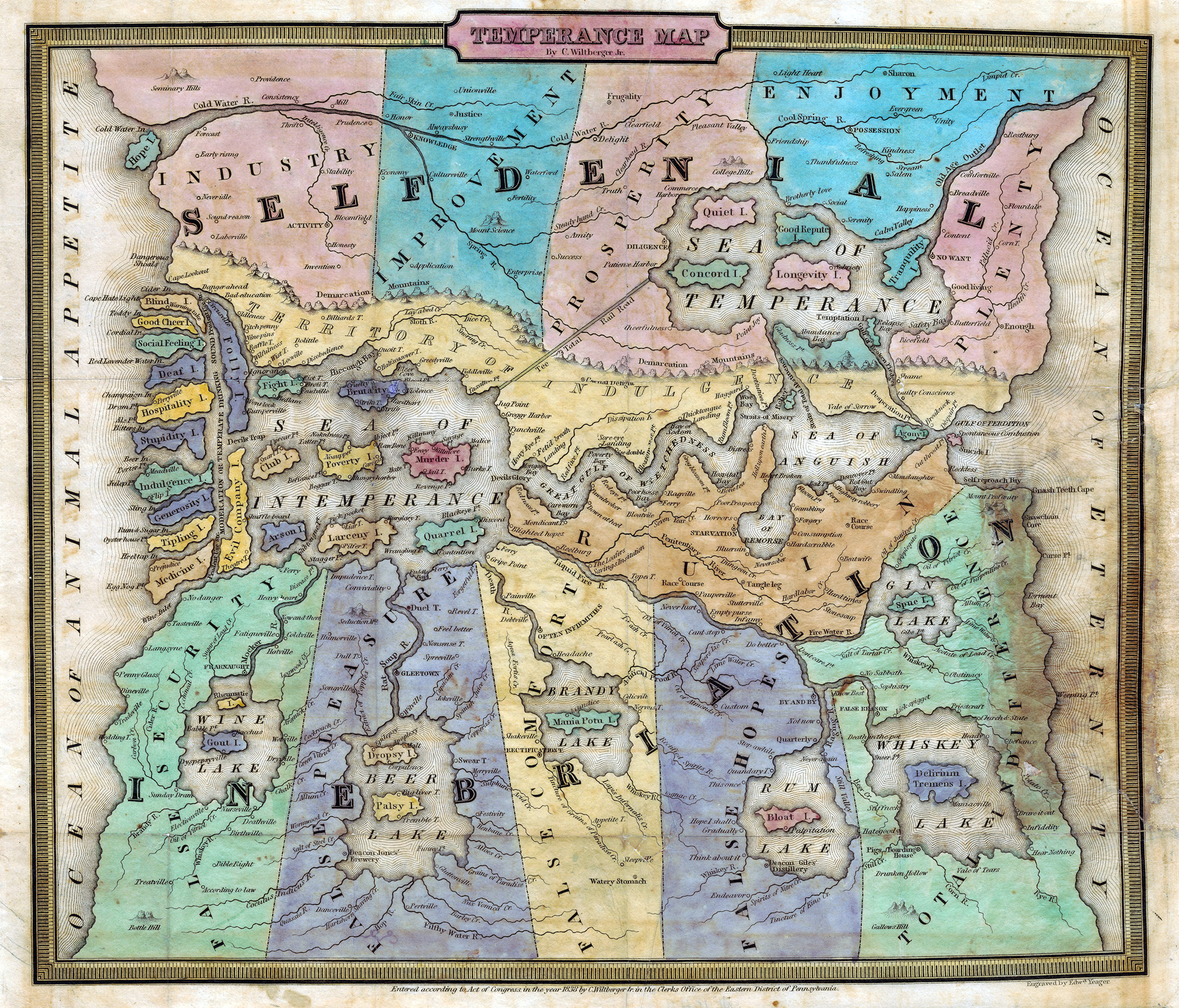
In Wiltberger’s map, the Land of Inebriation sits due south of the Land of Self-Denial, flanked by the Sea of Anguish and Great Gulf of Wretchedness. Islands are named Stupidity, Poverty, and Indulgence.
A northerly land of abstinence promotes such assets as Industry, Improvement, Prosperity, and Enjoyment, and the vaguely named “Plenty.” All are visualized as geographic provinces.
An 1831 map, titled “Isle of Pleasure,” presents a counterargument. Created by Henry Jefferson Lawrence, an architect in Houston, the map satirizes the temperance reform movement.
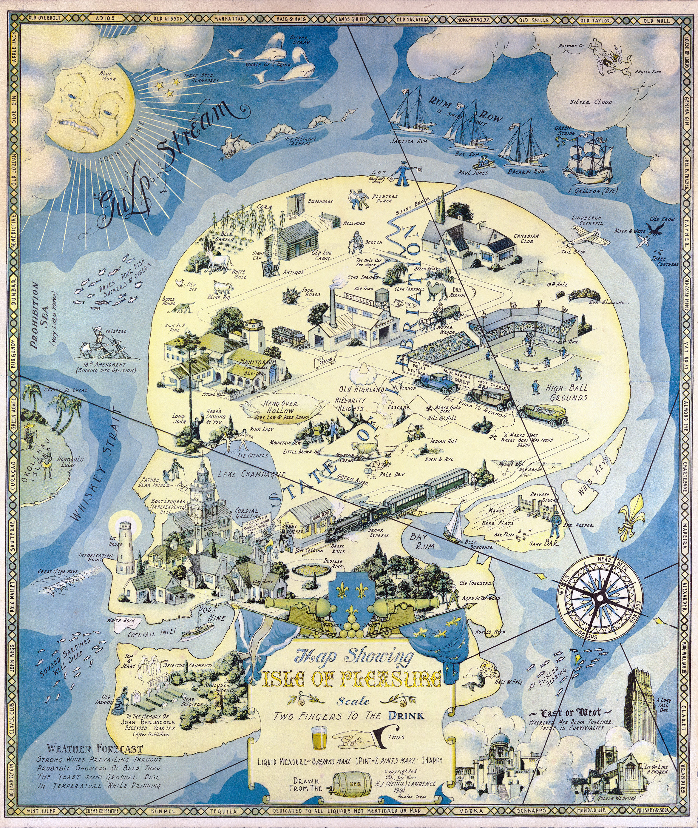
A skull-shaped island named The State of Inebriation is flanked by the Whiskey Strait and Gulp Stream. The punny wordplay continues across the Hill-Arity Heights, Port Wine, and such grazing wildlife as a Blind Pig and Booze Hound. A Blue Moon sits on high, gazing across the Isle of Pleasure.
Two maps. Innumerable alcoholic options. The decision is yours.